
South Pasadena and original Raymond Hotel
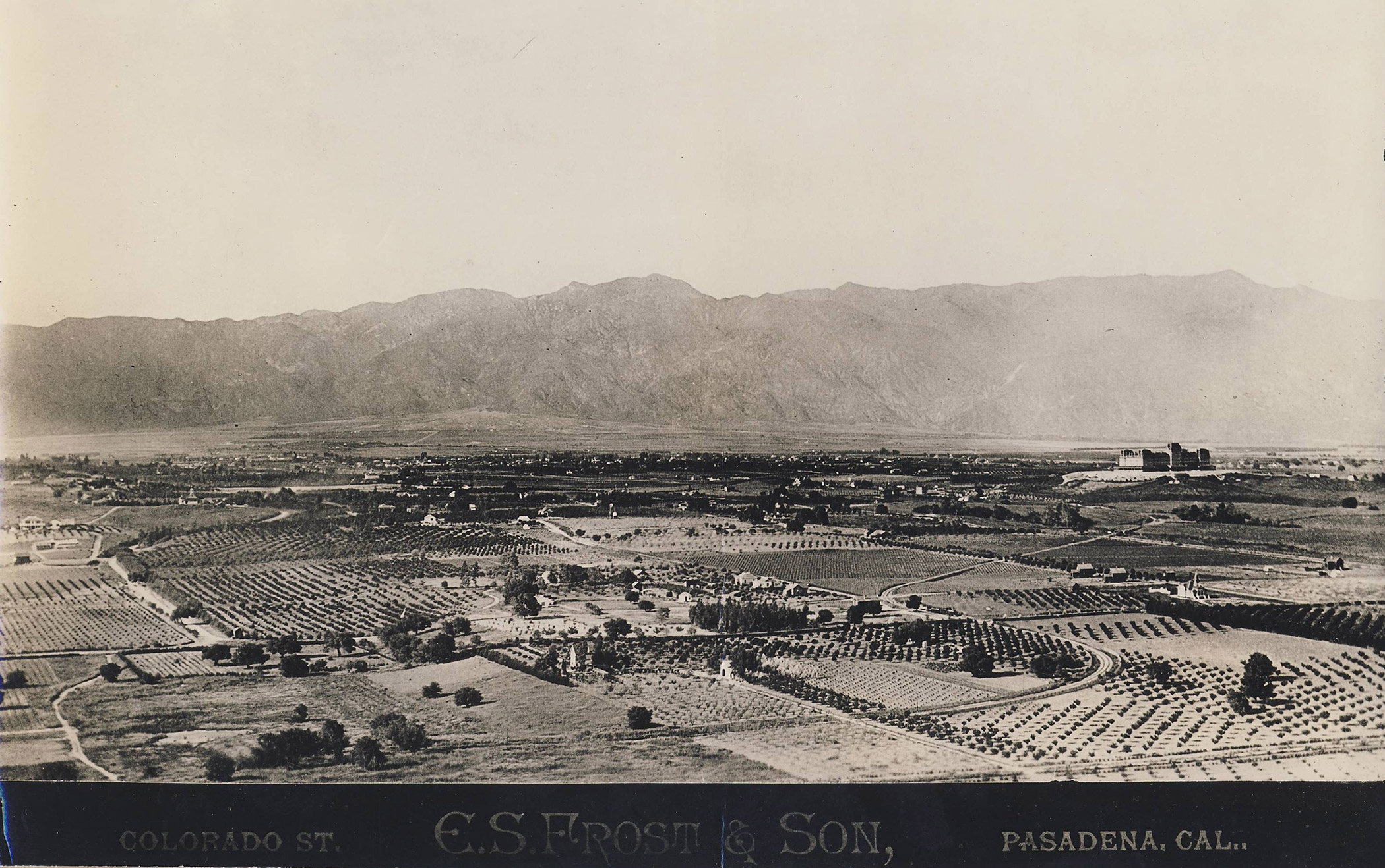
E. S. Frost & Son Photographers, Colorado Street, Pasadena, Cal. On the back is stamped C. C. Pierce & Co. Photographers, 313 S. Spring Street, Los Angeles, Cal. Written in pencil is negative number 6423 and “South Pasadena, Hotel Raymond on the hill. the railway tracks that curve through the fields belonged to the Los Angeles Terminal Railway.” These tracks parallel the bottom left of the images and make a soft “S” curve toward the Raymond Hotel. In the distance can be seen Mount Wilson and the San Gabriel Mountains, before there was a peak named Mount Lowe or an incline railway.
Michael Patris Collection
Recent Posts

Showing 3 comments
Speechless.
I recently found a large format photo shot from the hotel’s grounds looking outward across the valley from a garden area.
Wait a minute…that snaking track is the Los Angeles & San Gabriel Valley (Santa Fe) line which will enter the cut below the western edge of Raymond Hill. The Los Angeles Terminal (Union Pacific) made a hard turn north at the Arroyo bridge site and came along on a straighter shot eastward towards the cut. P&LA/LA&P/PERy ran between the two and came east on Mission (Santa Fe crossing over it) below where the cut had been. [The bridge over them (UP/SF) allowed Fair Oaks to be connected down to Oneonta Park, effecting a switch in Huntington’s original name of his tract’s section of the road.] There is at least one older map which makes the mistake of reversing the railroad names, even though the South Pasadena Santa Fe station is properly labled. Could the person making the pencil notes have been confused by one of these bad maps?